About this place
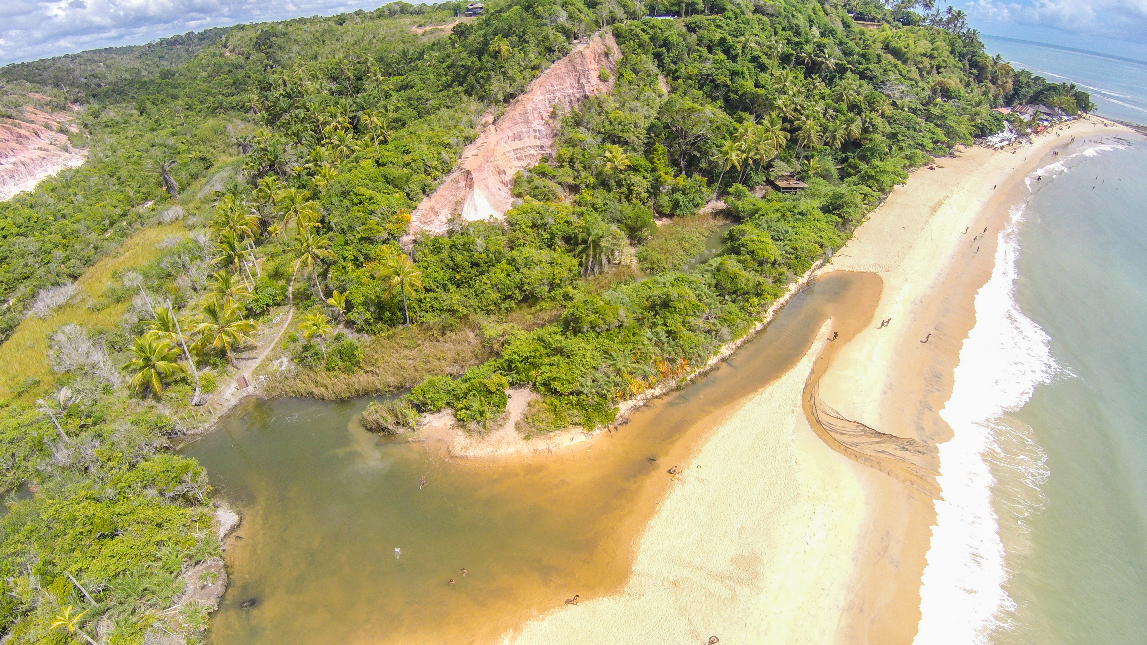
On one side is the mouth of the Rio da Barra, with the diversity and beauty of the mangrove. On the other is the Atlantic Ocean. This is the spectacle tourists expect to find, but the place offers other charms. A few meters before its mouth, the river forms a bay with warm, calm waters. Meanwhile, on the other side, the waves surge forward and crash against the cliffs. Encounters with preserved Atlantic vegetation are also characteristic of the place. This place is part of Rede Bem Bahia’s Regional Guide and helps visitors understand the natural, historical, cultural and scenic diversity of the Costa do Descobrimento. The experience changes according to the time of day, tide, weather, calendar and means of access. Plan your visit with travel, length of stay and current rules in mind, and confirm operational information before leaving.
Things to do
Sail, admire mangroves, reefs or river mouths, and observe wildlife from a responsible distance, always following the crew's or guides' instructions. Allow time to notice the details presented in the attraction description and take photographs responsibly.
Travel tips
Confirm tide, wind, duration, included items and safety equipment before boarding.
Practical planning
- Suggested duration
- Half a day to a full day
- Best time
- Depending on tide, wind and authorized operations
- Costs
- Tours and crossings usually require payment
- Accessibility
- Boarding and disembarking require prior confirmation
- Advance booking
- Recommended, especially in high season
- Seasonality
- Operations subject to navigation conditions
Approximate distances
- Porto Seguro airport
- approx. 18–80 km
- Porto Seguro town centre
- approx. 15–75 km
- Bus terminal
- approx. 18–80 km
- Coroa Vermelha
- approx. 35–95 km
- Mundaí
- approx. 25–85 km
- Arraial d’Ajuda
- approx. 1–65 km
Distances are estimates, not journey times. Confirm the route and any ferry crossings before departure.